
Warsaw Metro / Subway Map
This page features the map of the Warsaw metro. The Warsaw metro (subway, tube or underground) is one of the transit systems serving Warsaw, Poland, alongside suburban trains, trams and buses. The network has 2 lines and 39 stations covering 25 miles (41 km).
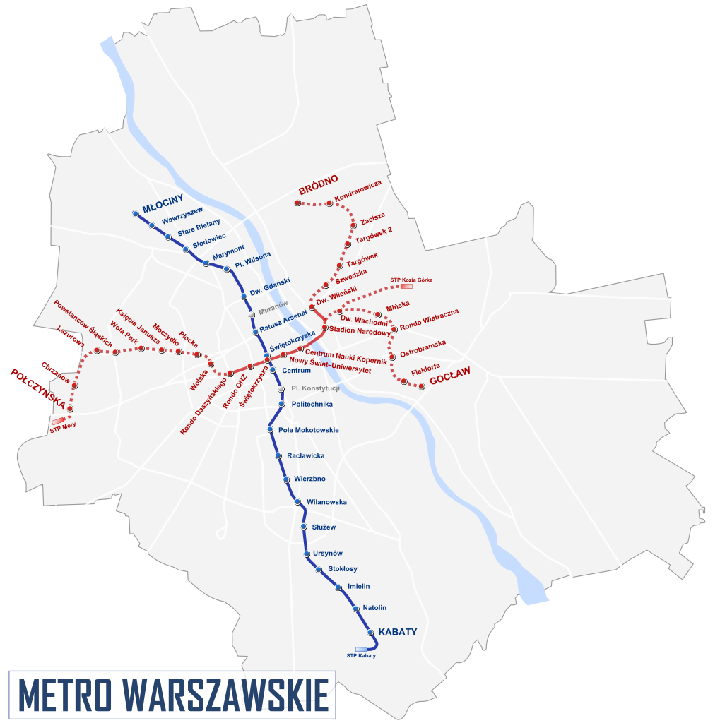
Warsaw subway map
The Warsaw metro (subway), which carried 193 million passengers in 2025, opened in 1995 and is operated by Metro Warszawskie. A western extension of line M2 to Karolin, with three new stations, is under construction.
Its network consists of the following 2 lines:
• Line M1: Młociny ↔ Kabaty
• Line M2: Bemowo ↔ Bródno