
Warsaw Train Map
This page features the maps of Warsaw's suburban trains: SKM, WKD and Koleje Mazowieckie (KM). Warsaw's urban, suburban and commuter trains are a transit system serving Warsaw, Poland, alongside the metro, trams and buses. SKM runs 5 lines, WKD runs 1 line with a branch, and Koleje Mazowieckie runs many regional lines radiating from the capital.
Warsaw SKM Map
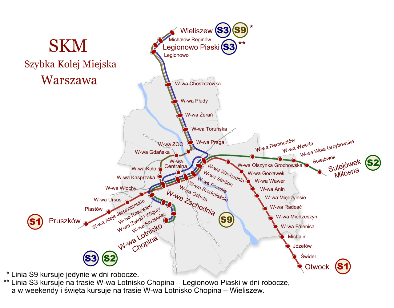
Warsaw SKM map
Warsaw's SKM trains, which carried 23.8 million passengers in 2025, have been running since 2005 and are operated by Szybka Kolej Miejska (SKM).
Its network consists of the following 5 lines:
• Line S1: Pruszków ↔ Otwock
• Line S2: Warszawa Lotnisko Chopina ↔ Sulejówek Miłosna
• Line S3: Warszawa Lotnisko Chopina ↔ Legionowo
• Line S4: Piaseczno ↔ Zegrze Południowe / Wieliszew
• Line S40: Piaseczno ↔ Radzymin / Wieliszew
Warsaw WKD Map

Warsaw WKD map
Warsaw's WKD trains have been running since 1927 and are operated by Warszawska Kolej Dojazdowa (WKD).
Its network consists of the main line Warszawa Śródmieście WKD ↔ Grodzisk Mazowiecki Radońska and the branch Podkowa Leśna Główna ↔ Milanówek Grudów.
Warsaw KM Map

Warsaw KM map
Koleje Mazowieckie (KM), founded in 2004, has been running regional trains since 2005; more than 70 million passengers traveled on its network in 2025.
From Warsaw, its lines run to Modlin (RL line to Warsaw Modlin Airport), Działdowo, Skierniewice, Łuków, Kutno, Czyżew, Dęblin, Radom and Skarżysko-Kamienna, complemented by regional lines such as Siedlce ↔ Czeremcha, Radom ↔ Drzewica and Nasielsk ↔ Sierpc.